HGIS de las Indias
A Digital Atlas of Late Colonial Spanish America
menu
HGIS Two column
About HGIS de las Indias
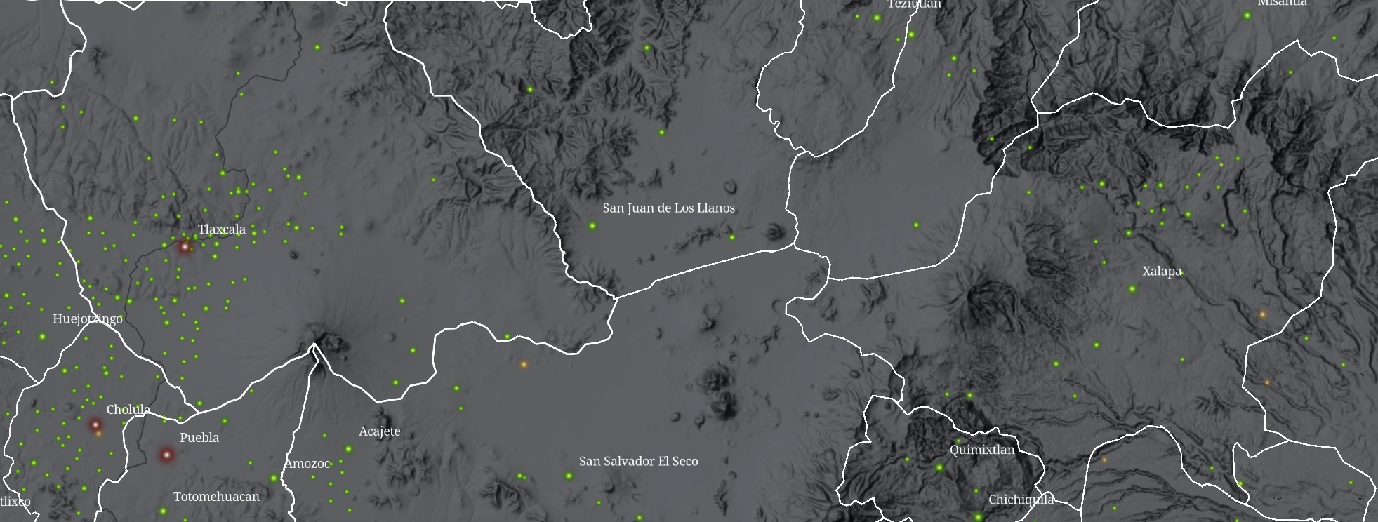
HGIS de las Indias is a collaborative digital humanities initiative that compiles and publishes open-access spatio-temporal data focusing on the late colonial Spanish America period (years ~1701-1808). Through a growing collection of maps, datasets, and interactive tools, the platform offers insight into the administrative divisions, settlements, religious missions, communication networks, and economic activities of the period. With a historical gazetteer, reconstructed geographies, and detailed metadata, HGIS de las Indias supports scholars, educators, and the public in understanding the layered, contested spaces of the early modern Americas.
Use the WebGIS tools to trace the shifting boundaries of jurisdictions, discover where indigenous communities lived and resisted, follow the routes of postal couriers and galleons, and examine population data from censuses and archival sources. Use the gazetteer to search, explore and navigate information on individual places and territories.
HGIS de las Indias is a key component of ARCA (Archive and Resource Center for the Americas), a collaborative initiative aimed at uniting diverse datasets and resources, building a data landscape for the field. Within this effort, it is a key connecting resource, relating the datasets through a shard framework. Via integration in World Historical Gazetteer, HGIS de las Indias also connects data also to the wider world of Linked Open Data as a part of the Semantic Web.
Content will be updated soon!
Featured Project: Cartography
This project will build a comprehensive database with immigrant flows from Spain and Africa to the Americas since the Conquest in 1492 until today. By tracking immigrant flows, we will estimate the human capital brought by voluntary and involuntary migrants and their migration networks in Spain and in the Americas.

Links
We thank the support of the following organizations:
American Historical Association
Asociación Peruana de Historia Económica
European Historical Economics Association
Copyright: Leticia Arroyo Abad and José Antonio Espin-Sánchez 2021
Funded by NSF award number 2121697